AI-generated summary reviewed by our newsroom.
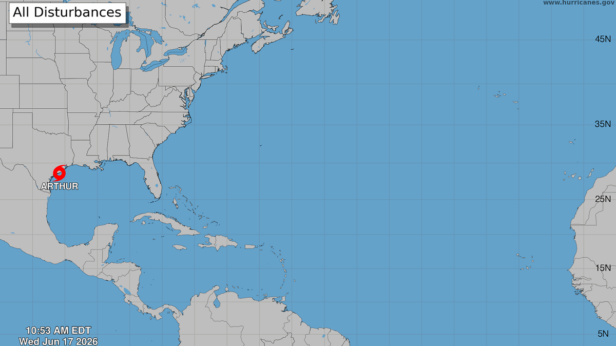
Tropical Storm Arthur, the first named storm of the Atlantic hurricane season, is forecasted to bring life-threatening flooding and inches of rain in parts Texas and Louisiana.
Read more What’s next for Carolina Hurricanes goalie Frederik Andersen?
The storm, named at 11 a.m. Wednesday, June 17, is expected to weaken as it continues northeast, and it’s unlikely North Carolina will see any major impacts from the storm, meteorologists said.
“From that point on it is just going to be a rainmaker,” said Gail Hartfield, meteorologist with the National Weather Service’s Raleigh office. “It’s going to be a nasty rainmaker for southeast Texas, Louisiana and into Mississippi. I don’t want to downplay that for them, because it will be a significant rain for them.”
The National Weather Service is forecasting 5 to 10 inches of rain with some isolated totals near 20 inches through early Friday along the northeast Texas coast, central portions of Louisiana, Mississippi and Alabama, and western portions of Georgia and Florida panhandle. Some of the weather models, sometimes called spaghetti models for the lines plotted across the map, show the storm’s remanents over North Carolina.
“Whatever disturbance is left over from Arthur that is going to track across the Southeast,” said Victoria Oliva, meteorologist with the National Weather Service’s Wilmington office. “Whether or not it gets to North Carolina or our neck of the woods is still questionable.”
The concern would be isolated storms or the potential for gusty winds Thursday night, she said.
“(In the Triangle), it looks like it’s going to mostly be skirting by our south,” Hartfield said. “It may clip southeastern North Carolina, so if you’re at the beach in the south, southeast coast of North Carolina, it may be a little bit wet, but overall, the rainfall will be south of the Triangle.”
Read more Drug overdose leads to manslaughter charge in Chatham County
The National Weather Service is predicting a below-normal hurricane season in the Atlantic Ocean this year, partly due to warming waters from an expected strong El Niño.
This hurricane season, which began June 1 and continues through Nov. 30, has a 55% chance of being below normal, 35% of being near-normal and 10% change of an above-normal season, according to the official forecast released Thursday, May 21, during a press conference.
The official forecast predicts:
These storms are categorized based on wind speed, which helps predict potential property damage, The News & Observer previously reported. Danger from other hazards like flooding, storm surges and tornadoes are not factored into the storm’s categorization.
According to the National Hurricane Center, storms are classified as:
The World Meteorological Organization released the list of names to use in the 2026 Atlantic tropical cyclone season. The names are:
Read more Collin Gosselin’s New Book to Reveal What Really Happened in His Childhood
Portions of this story were previously published in The News & Observer.