
AI-generated summary reviewed by our newsroom.
Residents in Wake, Durham, Orange, Chatham and Johnston counties are under a severe thunderstorm watch until 9 p.m., according to the National Weather Service.
Read more How Taylor and Travis’ Wedding Guests Reacted to Adam Sandler Officiating
At 2:31 p.m., radar indicated severe thunderstorms in mainly rural areas of west central Granville County, bringing wind gusts of 60 mph and prompting the NWS to instruct residents to “move to an interior room on the lowest floor of a building” and “expect damage to roofs, siding, and trees” until 2:45 p.m.
NWS radar spotted similar thunderstorms in Vance and Warren counties, north of Raleigh. The storms were moving northeast at 30 mph as of 2:36 p.m., according to the NWS. Those counties — including Interstate 85 between mile marker 209 and 233 — were under a severe thunderstorm warning until 3:30 p.m.
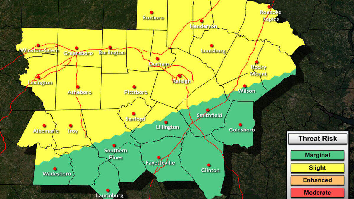
The NWS rated the risk of thunderstorms as slight for most of the Triangle, meaning any severe storms will likely be scattered and short-lived. Still, during a thunderstorm watch, the NWS recommends residents have a plan of action and check forecasts regularly.
Read more 3 Movie Masterpieces You Need to Watch on Netflix in July 2026: ‘Scream’ and More
A heat advisory issued for the Triangle by the NWS remains until 9 p.m. Saturday, with heat index values forecasted to reach 109. A mix of high temperatures and 77% humidity may cause heat illnesses, so the NWS recommends:
Saturday’s high of 98 degrees is short of the July 18 record of 103 degrees set in 1887. But temperatures are expected to fall only as low as 79 degrees in Raleigh Saturday night — just short of the highest record low of 80 degrees in 2025.
Read more Texas burger chain eyes former Triangle mall, as home goods store gets settled
This story was originally published July 18, 2026 at 10:36 AM.