
AI-generated summary reviewed by our newsroom.
The flooding and closure of N.C. 12 through the Pea Island National Wildlife Refuge on Hatteras Island again raises the question: Is there any way to keep the Outer Banks highway open during coastal storms?
Read more 3 hikers airlifted to safety after getting lost in Big Sur wilderness
The N.C. Department of Transportation, which owns N.C. 12 and must clear the seawater and sand and fix the pavement after big storms, is asking that question in a two-year, $1.86 million study it calls SAND — Solving Access for NC 12 in Dare County.
The study, financed by the federal government, will look at ways of making N.C. 12 less vulnerable to the Atlantic Ocean in the refuge. Options include moving sections of the highway, building one or more bridges out over Pamlico Sound and/or putting more effort into building up the beach and protective dunes.
NCDOT held a series of public meetings to solicit ideas in April and will provide updates at three more public meetings in November. Results of the study aren’t expected until next summer.
N.C. 12 extends 11 miles through the Pea Island refuge just south of Oregon Inlet and the Marc Basnight Bridge. The highway separates the ocean dunes from the marshes and impoundment ponds along the Pamlico Sound that attract ducks, swans, geese and other waterfowl.
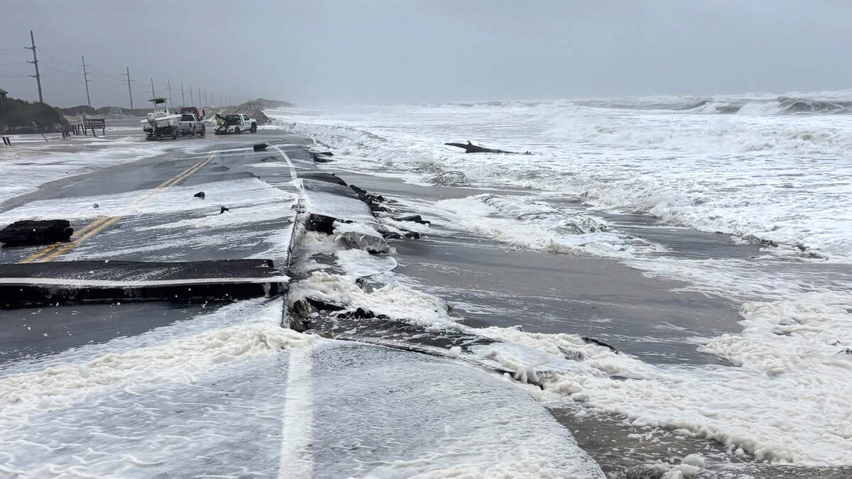
The powerful nor’easter that rode up the coast last week forced NCDOT to close N.C. 12 through the refuge early Thursday morning, Sept. 24. Tidal surges washed away the dunes and covered the road with four feet of water in some places. When the water receded, it left about 1,000 feet of buckled and broken pavement that NCDOT crews are working to repair.
NCDOT says it hopes to allow northbound traffic to exit the island on a one-lane temporary road through the refuge starting Wednesday morning.
Read more New book blows lid off Tom Brady’s divorce. What was the final straw?
In the meantime, NCDOT began 24-hour emergency ferry service between Stumpy Point on the mainland and the community of Rodanthe, south of the refuge. The ferries began running at 11 a.m. Sunday, with three boats making the roughly two-hour trip across Pamlico Sound.
Dare County is restricting access on the Rodanthe-bound ferries to essential personnel, critical business vendors and permanent Hatteras Island residents. Visitors are being turned away.
The exposure of N.C. 12 to the Atlantic Ocean has long been a problem in the wildlife refuge. In 2011, Hurricane Irene cut a new inlet through the refuge that forced NCDOT to build a half-mile long bridge (the inlet has since filled with sand).
The ocean frequently washed over an area known as the “S-curves” at the southern end of the refuge near Rodanthe, where several houses have fallen victim to the surf. NCDOT bypassed the S-curves in 2022 when it opened the 2.4-mile Rodanthe Bridge that juts out into Pamlico Sound.
Environmental groups had pressed NCDOT to build a much longer bridge that would bypass the wildlife refuge altogether starting north of Oregon Inlet. But NCDOT said the 17-mile bridge would have been prohibitively expensive.
Read more For the Hurricanes, it’s time to raise a new banner and start a new season
This story was originally published September 28, 2026 at 2:30 PM.