
AI-generated summary reviewed by our newsroom.
The threat of a powerful early-season Nor’easter is prompting flood watches and warning of ocean waves that can reach up to 12 feet along some parts of North Carolina’s Outer Banks.
Read more A WRAL anchor is leaving the station after 5 years. Here’s what we know
A coastal low-pressure system is building off the North Carolina coast that is forecasted to bring dangerous surf conditions, strong winds, rip currents and coastal flooding.
“This will be a prolonged coastal event, coastal and marine,” said Rohan Jain, meteorologist with the National Weather Service’s Morehead City’s office. “Inlands areas will see minimal impacts, but the beaches and waters will see the brunt of it here, and we’ll have a prolonged period of north, northeast winds with gale force gusts that could produce some coastal flooding concerns and really high waves, strong waves.”
The High Surf Advisory warns of a high risk of rip currents and large breaking waves between 8 and 12 feet possible in Currituck County from Tuesday, Sept. 22 until through late Thursday, as of 3 p.m. Tuesday. The Flood Watch is in effect for oceanside areas from Duck to Ocracoke.
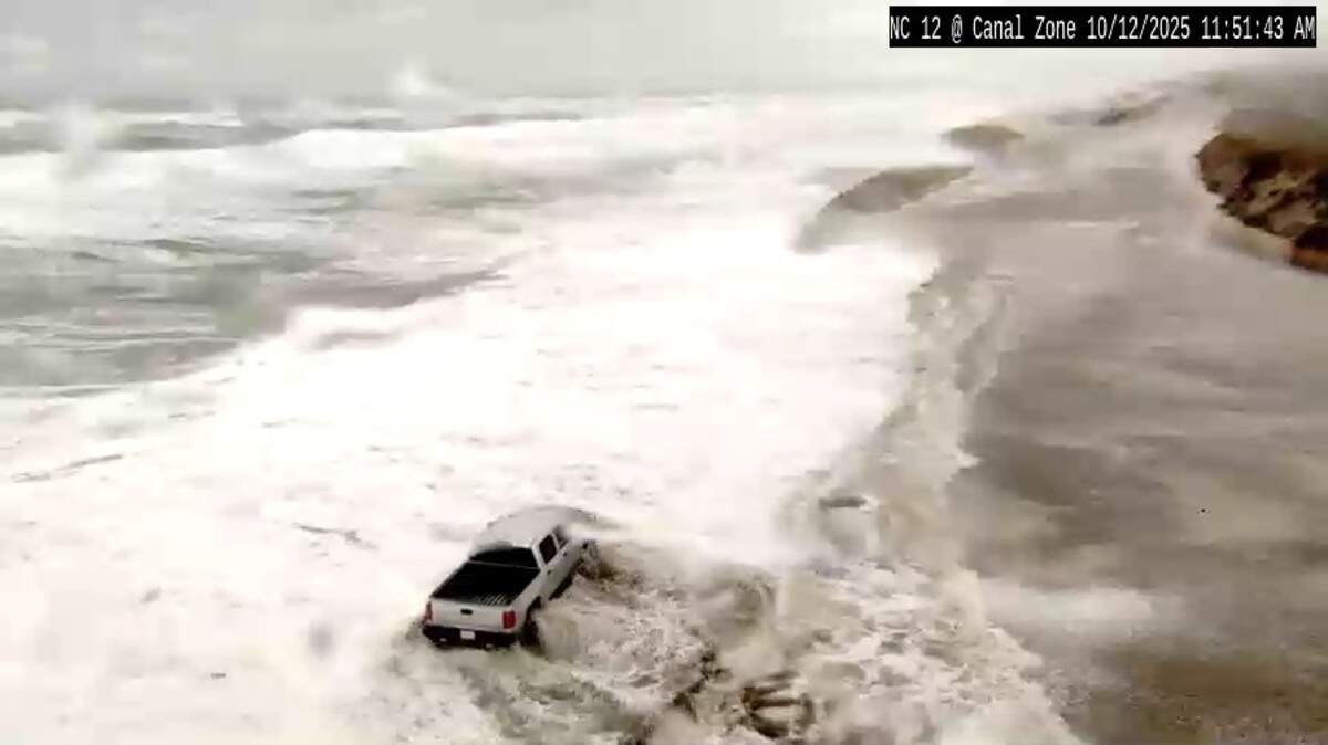
“Strong winds are forecast to bring rough seas, dangerous surf and large breaking waves late this week and into the weekend,” according to Michael Duquette, meteorologist for the North Carolina Department of Public Safety. “The strongest winds and greatest risk of coastal impacts are expected Thursday into Friday, and will lead to beach erosion, ocean overwash at vulnerable locations including Highway 12.”
The North Carolina Department of Transportation attempted to fortify protective dunes along Highway 12 on Pea, Hatteras and Ocracoke islands and warned drivers of possible hazards on Tuesday afternoon.
“If the forecast holds, difficult driving conditions along N.C. 12 are likely, particularly during high tide cycles, peaking with the Thursday evening and Friday morning high tides,” according to NCDOT. “Overnight travel may become especially hazardous at times, and temporary closures of the highway are possible.”
Moderate to strong winds are expected to peak Thursday into the night, bringing possible power outages and some tree damage, according to a Tuesday briefing from the National Weather Service. Wind gusts are forecasted to peak at 49 miles per hour in Rodanthe and 47 miles per hour in Ocracoke.
Read more 2 NC destinations rank among the nation’s best for millennials. Here’s why
There is still uncertainty of how strong or where exactly the nor’easter will end up, but there is a “high confidence” it will bring strong winds and waves, Jain said.
“The waters are going to be very dangerous,” he said. “Waves 15 to 20 feet along the Gulf Stream, winds of gale force gusts expected for a lot of our waters.”
A nor’easter last year helped put more than a dozen houses and hotel buildings along the Buxton waterfront into the surf, an area on Hatteras Island where heavy erosion has brought down homes.
Further inland in central North Carolina, the nor’easter will contribute to the area’s cold air damming pattern where cold air gets trapped by the Appalachian Mountains, bringing cooler temperatures.
Temperatures aren’t forecasted to reach 80 degrees the rest of the week in Raleigh and Durham with a projected high of just the mid-60s on Thursday in the Triangle and upper 60s in the Charlotte area.
“It will be very underwhelming for central North Carolina,” said Aaron Swiggett, meteorologist with the National Weather Service’s Raleigh office. “If you’re around and along the coast, it’ll be a bit more significant.”
People can check beach conditions and the risk of rip currents by visiting weather.gov/beach.
Read more Student’s walk-on kicking chase earned a D-I look. But UNC football is his dream