
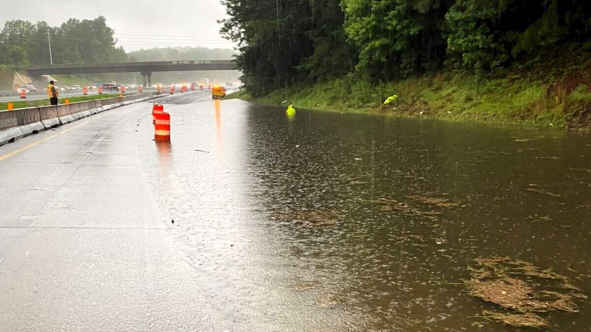
The slow moving storms, which could dump 6 inches of rain throughout the day, arrived in the Triangle Thursday morning.
Read more David Tepper playfully pitched a Charlotte Super Bowl. Roger Goodell responded
A flood watch is in effect for central North Carolina, including the Triangle, as slow moving fronts travel across the state. A few of the storms could become strong to severe, “with gusty winds or even a brief tornado,” according to the National Weather Service’s Raleigh office.
“Continuous rounds of showers and storms through the day will produce 2 to 4 inches of rain, with locally higher amounts of 6+ inches (mainly across the Triangle area),” according to an early morning briefing from the National Weather Service. “Scattered instances of flash flooding will be possible, with the greatest risk over the northeast Piedmont and northern and central Coastal Plain, including in the Triangle.”
As of 1 p.m. Thursday, the strongest bands of storms have moved south of the Triangle prompting a flash flood warning in the Fayetteville area and a flood advisory in parts of Harnett and Lee counties.
But that doesn’t mean the Triangle is in the clear.
Additional heavy pockets of rain will move across the state, including in the Triangle, in the afternoon and into evening, said Nick Petro, warning coordination meteorologist with the National Weather Service’s Raleigh office, though it may become spotty.
The National Weather Service released 24 hour rain totals, as of 3 p.m. Here are the highest totals in the Triangle:
Some places in the Triad, where the storms moved from Wednesday and overnight, saw rain reach more than 6 inches including 7.74 inches in High Point, 6.64 inches in Burlington and 6.5 inches in Greensboro.
Read more Which ‘Big Bang Theory’ Stars Did – And Didn’t – Appear on ‘Stuart’ Spinoff?
Parts of Interstates 85 and 40 are closed in some areas due to flooding, according to the Orange Rural Fire Department in Hillsborough.
“We are responding to multiple calls for flooded roads, cars in the water and trees down,” according to the fire department. “If you have to go out, give yourself extra time. I85/40 is shut down due to flooding. If you usually travel the interstate between Hillsborough and Efland to work or home, find a different route and stay off the interstate.”
A flash flood warning was issued early Thursday morning for Durham County, Orange County, Alamance County, northern Chatham County and southern Granville County until 11 a.m.
A flash flood warning was issued at 9:28 a.m. for southwestern Wake County, Moore County, Lee County, southern Chatham County and central Harnett County are under a flash flood warning until noon.
As of 11:30 a.m., most mainstem rivers, which includes the Yadkin, Cape Fear, Neuse, Tar and Roanoke rivers, are expected to peak near or below flood stage, or where the water begins to overflow its banks.
Read more What Happened When Police Responded to Eminem’s Ex-Wife’s Suicide Attempt
Drier weather is expected later in the weekend and into early next week.
Reporter Tammy Grubb contributed to this report. This story has been updated.
This story was originally published July 23, 2026 at 8:34 AM.