
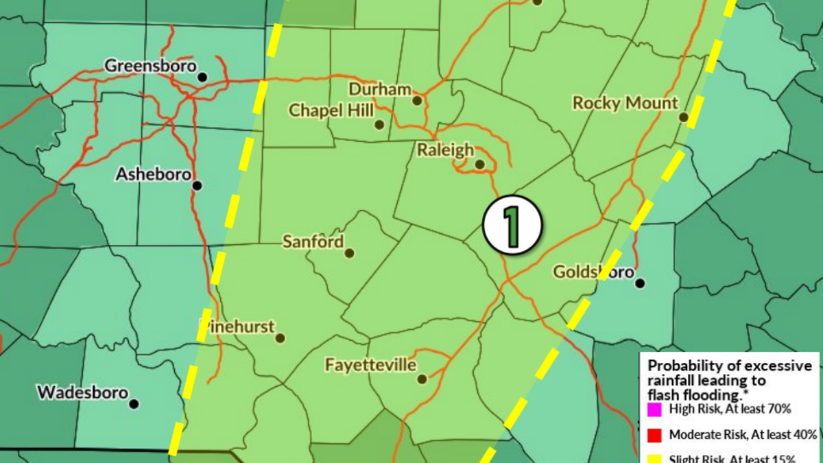
Raleigh and Central North Carolina are bracing for a wet and potentially turbulent end to a sunny weekend, as forecasters warn of heavy rain and flood risks starting Sunday.
Read more Man accused of killing UNC student Faith Hedgepeth nearly 14 years ago enters plea
Showers and thunderstorms are expected across the region, according to the National Weather Service (NWS) in Raleigh. There’s an 80% chance of rainfall and highs near 88 degrees and some areas may see multiple rounds of heavy downpours.
The NWS Hazardous Weather Outlook warns that rain amounts could reach 2 to 4 inches. The weather alert is mainly in Central North Carolina, specifically Wake, Durham, Orange, Forsyth, Guilford, Cumberland, Moore, Wayne and Johnston counties.
Flash flooding is a low threat for urban areas and locations with poor drainage. Residents are advised to avoid driving through standing water.
NWS also says some storms Sunday may produce severe wind gusts, but that threat remains conditional.
Read more Publix recalls more fruit linked to stomach illness at NC grocery stores
Throughout the week, stormy weather will continue, according to the NWS.
Monday and Tuesday both carry high chances of showers and thunderstorms, which could bring even more heavy rainfall and potential flooding.
Temperatures Wednesday and Thursday will reach 89 degrees in Raleigh, with another possible thunderstorm Thursday afternoon.
Last week, Raleigh lifted water restrictions thanks to recent rains that helped replenish the levels in Falls Lake and helped drought conditions. The water supply in the lake is at 84%.
Read more Conservation group buys another big chunk of Johnston County wilderness
Restrictions are set to end Monday.
This story will be updated with more weather conditions.
This story was originally published August 2, 2026 at 10:23 AM.