
AI-generated summary reviewed by our newsroom.
The city of Durham has three possible paths to consider in reimagining the Durham Freeway as part of an effort to “right the past wrongs.”
Read more Leslie Mann and Anna Faris Flaunt Bikini Bods With ‘Spa Weekend’ Costars
The City Council received the final report of a study Thursday that looks at the options for N.C. 147 between Swift Avenue and the East-End Connector at Interstate 885. Council members celebrated what they described as a step toward addressing the damage to Black neighborhoods caused by the freeway’s construction in the 1960s and 1970s.
The three proposals in the Community Vision Plan are: converting the freeway into a street-level boulevard; capping portions of the freeway with land bridges; or modernizing the current freeway.
The study doesn’t recommend either of the options, and the Durham City Council took no action at the Thursday meeting. The final report comes a year after the members first heard the recommendations based on the community-led effort to reimagine the highway.
“The government made a decision back then, and the government today is going to make a decision and I hope that we could right the past wrongs of what happened with our community being torn apart,” said Mayor Leo Williams.
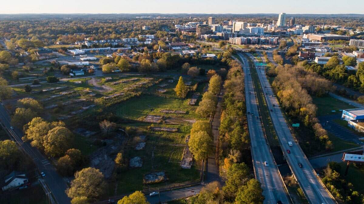
In the 1970s, the Durham Freeway, or N.C. 147, ripped through once-vibrant Black neighborhoods, displacing homes, businesses and places of worship and severing connections between communities. Most notably, the Hayti and the Brookstown neighborhoods were decimated by the freeway’s construction.
The study’s stated goal was to acknowledge those harms and explore ways to reconnect central Durham.
In 2024, the city began the study with a project team led by WSP USA. The work included technical analysis of traffic, land use, transportation and demographics, as well as historical research. The city also formed public engagement committees in an effort to rebuild trust with residents affected by the freeway.
All three options would require coordination with the N.C. Department of Transportation (NCDOT), which owns and maintains the freeway. The report also identifies anti-displacement policies and a mix of potential local, state, federal and private funding.
With this option, the freeway and interchanges would be replaced with a street-level boulevard focused on neighborhood connections and public spaces. The report says it would offer the most opportunity to reclaim land for affordable housing, parks and cultural landmarks. The preliminary cost estimate is about $500 million, and the work could take 10 to 15 years from planning to construction.
This option would keep the freeway but build caps, also known as concrete covers, or land bridges, over it at locations like Fayetteville and Mangum streets and the area between Duke and Chapel Hill Street. Those bridges could restore portions of the historic street grid and create new green space and development above the freeway.
The cost estimate ranges from $450 million to over $800 million, and would be built in phases over 10 to 20 years.
Read more Iryna Zarutska’s family files suit blaming city of Charlotte in light rail killing
With modernization, the existing infrastructure would be upgraded with safety and traffic improvements. The freeway’s footprint would also be reduced in some downtown areas. This option would add opportunities for safer pedestrian and bike crossings and could create greenspace. However, the freeway would remain a physical and social barrier for residents nearby.
This is the cheapest option at about $450 million and could be completed in 10 to 15 years.
Council member Matt Kopac said the boulevard and cap options offered the strongest possibilities for reconnecting neighborhoods, expanding public space and supporting affordable housing.
“The price tag of $500 million is definitely a little daunting,” he said. “There’s certainly an argument for why we want to be prepared on this. While 147 and these sorts of freeways across the country did a lot of harm, taking them down or redeveloping them in new ways doesn’t necessarily fix that harm.”
Kopac added the proposed options have the “potential to create new harms” because since the freeway’s construction, “a lot has grown up around it, where you have people who are not established in their homes, in their business.”
“I just want to be really careful if we move forward that that is kept in mind,” he said.
Now that the study is finished, the work is not, said Sean Egan, the city’s Transportation Director. This includes securing the funding.
Egan said the city has asked NCDOT for information about bridges, including their condition and remaining useful life. The city has also been working with the Reconnecting Communities Institute, which is providing technical assistance around the country in cities working on similar projects.
“We’re gonna continue doing some of this due diligence work in the background, but the benefit that we have now is that we really do have a community-led vision for the corridor,” Egan said. “There’s some technical work that we can continue to do so that when an opportunity does come around for partnership at the state and federal levels, we’ve got that strong foundation of the community-led vision.”
On Sept. 8, the vision plan will be presented at the Durham City Council meeting where the members could select an option or take further action.
Read more Kim Zolciak’s Son KJ Biermann’s Arrest and More Top Us Stories